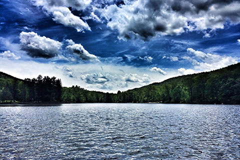
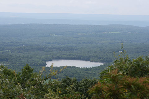
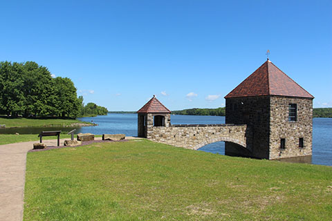
Cowans Gap State Park offers a 42-acre lake and many hiking trails providing scenic lake and valley views.
How To Get There: Lakeside Trail: Very pleasant, nearly level, scenic trail circling Cowans Gap Lake.
Tuscarora Trail: Once at the junction with Geyer Trail, take the Tuscarora Trail another 2.4 miles south to the top of Big Mountain for a spectacular overlook of the Path Valley and Franklin County.
Knobsville Road Trail: This road climbs to the top of Cove Mountain to a park overlook.
Greenwood Furnace State Park
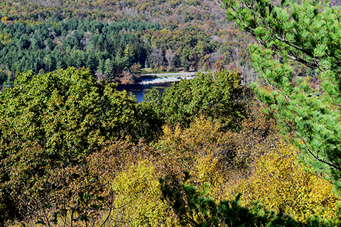
Stone Valley Vista, located in
Greenwood Furnace State Park, provides a breathtaking view of the surrounding valley and mountains of Huntingdon County.
How To Get There: The Stone Valley Vista Loop begins at the Standing Stone Trail parking area on PA 305 across from the park office. A steady two mile climb up the spine of Stone Mountain to the Stone Valley Vista.
Kings Gap Environmental Education Center
Kings Gap Environmental Education Center is the home of Mansion Overlook, providing a breathtaking view of the Cumberland Valley.
How To Get There: Ridge Overlook: 0.8 mile, most difficult hiking. This linear, ridge-top trail with boulder outcrops and a view of the valley below presents a more challenging hike.
Rock Scree and Kings Gap Hollow trails provide access to Ridge Overlook Trail. Scenic Vista Trail: 2.5 miles, more difficult hiking.This linear trail offers rolling terrain on the way to a pleasant overlook. Benches are strategically placed to relax and enjoy the surrounding view of unbroken forest.
Pine Grove Furnace State Park
Full of natural and historical features, the 696-acre
Pine Grove Furnace State Park is at the northern tip of the Blue Ridge Mountains, in an area known as South Mountain offering views of Michaux State Forest, Laurel Lake, and surrounding mountains.
How To Get There: Pole Steeple Trail: The entire park can be viewed from this quartzite rock outcropping. The trail begins at the Pole Steeple parking lot, along the Railroad Bed Road by Laurel Lake and proceeds up Piney Mountain to the rocky overlook. Be cautious of steep grades and sheer drop, children supervision is advised.
Prince Gallitzin State Park
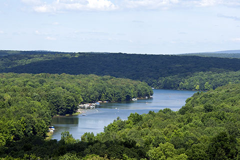
Situated in the forested hills of the Allegheny Plateau cradle
Prince Gallitzin State Park allows you to take in the view of the valley and hills along the 1,635 acre Glendale lake from the Headache Hill water tower.
How To Get There: Headache Hill is accessible from Long Road.
Samuel S. Lewis State Park

Samuel S. Lewis State Park is located on top of the 885-foot Mount Pisgah. It is the highest point in the area and offers a spectacular panoramic view of the surrounding Susquehanna River Valley, including surrounding towns and fertile farmlands.
How To Get There: Hilltop Pavilion: There is a wayside panel and coin-operated viewing scope allows visitors to view and identify various points of interest along the river valley.
Hilltop Trail: Winds through a pine plantation, interesting rock formations, and spectacular scenic views. This easy hike also takes visitors past the George E. Stine Arboretum.
Susquehannock State Park
The river overlooks of
Susquehannock State Park provide panoramic views of the lower reaches of the Susquehanna River. Hawk Point is the park’s main overlook offering a glimpse of the Conowingo Reservoir, the first and largest hydroelectric impoundments on the lower Susquehanna.
To the left, visitors can see Mt. Johnson Island, the world’s first bald eagle sanctuary, visitors can use the optical viewer or binoculars to spot eagles, osprey, turkey, and vultures.
Wissler’s Run Overlook gives an excellent view of the Susquehanna’s naturally rocky riverbed. The overlook also provides a view of the Muddy Run pump storage hydroelectric plant with the well-known Norman Wood Bridge in the background.
How To Get There: Overlook Trail, a more difficult 0.55 mile hike, will lead to Hawk Point and Wissler’s Run Overlook.
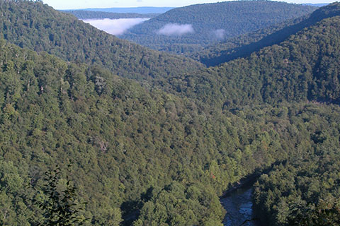
Trough Creek State Park

The 541-acre
Trough Creek State Park is a scenic gorge formed as Great Trough Creek cuts through Terrace Mountain before emptying into Raystown Lake.
How To Get There: Ledges Trail is a 0.91 mile more difficult hike. Starting at Trough Creek Drive below the park office and ends at Abbot Run Trail. The trail offers a panoramic view Great Trough Creek and the remnants of the old Paradise Furnace schoolhouse along the way.
Eastern Pennsylvania Vistas and Overlooks
Big Pocono State Park
From the summit of
Big Pocono State Park visitors can enjoy magnificent views including parts of eastern Pennsylvania and portions of New Jersey and New York can be seen a long the paved, 1.4 mile, scenic drive.
How To Get There: Rim Road offers multiple stops to view the overlook a long the scenic drive. Lot #3 connects to Vista Trail for another scenic overlook. Indian Trail offers a great view of the eastern cliffs, visible from I-80 and points in Tannersville and Scotrun.
Hickory Run State Park
Located in the foothills of the Pocono Mountains,
Hickory Run State Park provides scenic views overlooking the Lehigh River and Lehigh Gorge State Park.
How To Get There: Fireline Trail: About half a mile from the trailhead is a picturesque overlook of the Lehigh River and Lehigh Gorge State Park.
Skyline Trail: Loops through Gould Trail and heads on to cross Fireline Trail by the Lehigh River and continues on the edge of a steep slope that provides an excellent view of the Lehigh River.
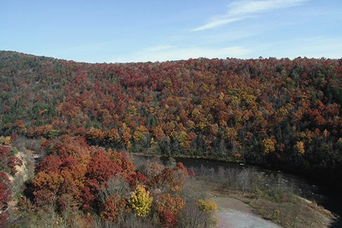
Lehigh Gorge State Park

The 6,107 acres of
Lehigh Gorge State Park land follow the Lehigh River from Francis E. Walter Dam in the north to Jim Thorpe in the south.
How To Get There: The Lehigh Gorge Trail follows over 20 miles of abandoned railroad grade along the river, providing opportunities for hiking, bicycling, sightseeing and photography.
Ralph Stover State Park
The High Rocks section of the
Ralph Stover State Park features an outstanding view of a horseshoe bend in Tohickon Creek Gorge and the surrounding forest.
How To Get There: High Rocks Trail is accessible from Stover Park Road.
Washington Crossing Historic Park

Bowman’s Hill Tower, located in
Washington Crossing Historic Park, is a 125-foot structure completed in 1931 to commemorate the American Revolution. The monument offers a commanding view of the Delaware River and surrounding countryside.
How To Get There: The tower roof can be reached by elevator and 23 stone steps. It is open seven days per week, March through December.
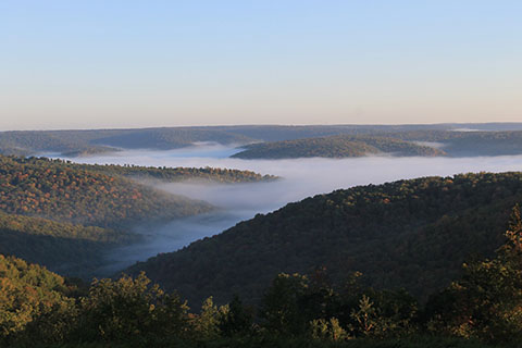
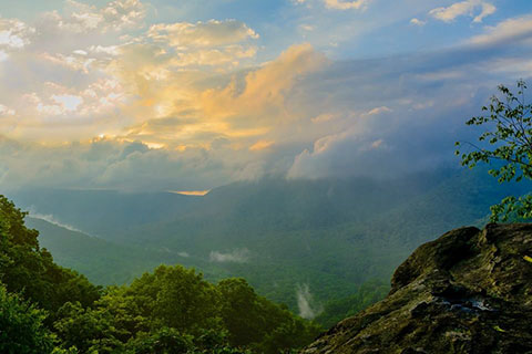
Worlds End State Park
Located in
World’s End State Park is an ADA accessible Loyalsock Canyon Vista and nearby High Knob Vista provide outstanding views of the Endless Mountain region. World’s End Vista and High Rock Vista offer stunning views overlooking the park beach.
How To Get There: Loyalsock Canyon Vista and High Knob Vista are accessible via Mineral Spring and Cold Run roads.
World’s End Vista is reached via World’s End Trail which begins at the park office.
High Rock Vista is reached via High Rock Trail which begins at the east side of the Cabin Bridge.
Western Pennsylvania Vistas and Overlooks
Cook Forest State Park

Located in scenic northwestern Pennsylvania
Cook Forest State Park offers two scenic overlooks. From the ledges of Seneca Point Overlook you can see the Clarion River Valley and an 80-foot climb up Historic Fire tower #9 provides a breathtaking view of the whole area.
How To Get There: Both are accessible from Fire Tower Road, about 1.5 miles from Route 36.
Laurel Ridge State Park

The Laurel Highlands hiking and backpacking trail runs from Ohiopyle to near Johnstown is the main attraction of
Laurel Ridge State Park offering many scenic overlooks along the 70-mile hiking trail.
How To Get There: Six trailheads provide 30-car parking lots, overnight parking, and trash receptacles.
McConnells Mill State Park

McConnells Mill State Park is located in Slippery Rock Creek Gorge, a National Natural Landmark. The steep-sided gorge contains numerous rocky outcrops, boulders, old growth forest, waterfalls and rare plants. The best view of the gorge is from Cleland Rock.
How To Get There: Cleland Rock overlook is accessible via an unpaved road off Breakneck Bridge Road.
Moraine State Park

Located in
Moraine State Park, Glacier Ridge Trail is a designated part of the North Country National Scenic Trail. The trail winds through forests, crosses streams, and offers scenic views of Lake Arthur.
How To Get There: Glacier Ridge Trail can be accessed at PA 528, Mount Union Road (TR 10050), Bike Rental Building, and McDanels Launch Area.
Ohiopyle State Park
Located in the southern reaches of the Laurel Ridge,
Ohiopyle State Park has the deepest gorge in Pennsylvania. Baughman Rocks and Tharp Knob Overlook offer spectacular views of the Youghiogheny River Gorge.
How To Get There: Baughman Rocks: The trailhead begins at the back of the Middle Yough Take-out parking Area adjacent to the Train Station/Visitor Center in downtown Ohiopyle and at the Mountain Biking Trail parking lot.
Tharp Knob Overlook: The short one mile loop that includes Tharp Knob Overlook is accessible via Kentuck trail, trailhead is located in the Tharp Knob Picnic Area.
Pymatuning State Park
Pymatuning State Park is one of Pennsylvania’s largest parks while Pymatuning Reservoir is the largest lake in the Commonwealth. Anywhere along the lake, beautiful vistas of this large body of water can be enjoyed.
Some of the more unique sights include the dam, the Linesville “spillway,’’ the fish hatchery, and the two causeways across the lake. The spillway is perhaps one of the best-known locations because the fish are so plentiful that the “ducks walk on the fishes’ backs” to compete for the food fed by the visitors.
How To Get There: The Spillway is located near Linesville and can be reached from US Rt. 6.