The Pennsylvania outdoors provides hiking enthusiasts and novices, families and solo trekkers, wildlife watchers and waterfall chasers, with many opportunities to enjoy the moment and make memories in the outdoors.
Pennsylvania has more than 11,000 miles of trails, and spring is one of the best times to enjoy them.
“Hiking is affordable, family-friendly and can be rambling or strenuous, depending on your preference,” DCNR Secretary Cindy Adams Dunn said. “For those who would prefer to start out with a guided hike, look for opportunities at the end of this month during Hiking Week from May 25 through June 2.”
DCNR partners with the Keystone Trails Association to offer organized hikes during Hiking Week that can be viewed on a calendar of events.
One of the best things about hiking is that it can usually be done close to home. Almost 6,000 local parks in Pennsylvania are listed on the Good for PA website, and many of them feature trails.
In addition, hiking is great exercise! It’s a powerful cardio workout that exercises almost every part of your body. It’s also good for reducing stress. Hiking in nature clears your mind, boosts your mood, and provides an overall sense of accomplishment when you reach your destination.
Many Pennsylvania state parks and forests provide great hiking experiences. Here are several trails in state parks and forests known to help hikers enjoy their journey and destination:
Breathtaking Scenic Views
West Rim Trail in Tioga State Forest
The West Rim Trail is a 30-mile hiking trail located adjacent to the Western Rim of Pennsylvania's Grand Canyon. The northern section of the canyon is about 800 feet deep and about 2,000 feet from rim to rim.
The exposed rock is estimated to be more than 350 million years old. Most of the important geologic process which formed the canyon as it now exists occurred less than 20,000 years ago.
The trail offers spectacular views of the canyon. In some spots, the trail follows the very rim of the canyon, so please watch your step!
Pole Steeple Trail in Pine Grove Furnace State Park and Michaux State Forest
The Pole Steeple Trail starts in Pine Grove Furnace State Park and ends in Michaux State Forest. The trail begins at the Pole Steeple parking lot, along the Railroad Bed Road by Laurel Lake, and proceeds up Piney Mountain to the rocky overlook.
The steep .75-mile climb takes you to a beautiful white and maroon colored quartzite rock outcropping where you can view the entire park.
The Pole Steeple Trail is the main trail used to reach the summit, but there is also a longer trail which heads out around the cliffs to the south side. Unlike the shorter Pole Steeple trail, you won't have to climb up any rocks to get to the top.
Mountain View Trail at Blue Knob State Park
Blue Knob State Park is named for its majestic dome-shaped mountain. Situated on a spur of the Allegheny Front and overlooking the scenic Ridge and Valley Province to the east, Blue Knob has spectacular views.
Mountain View Trail is a multi-use trail in the wilderness part of the park. The trail begins a short distance from the curve on Three Springs Trail. The trail makes a short, 0.9-mile “look out” loop before crossing the Three Springs Trail again.
The “look out” loop is suitable for the whole family, but the remainder of the trail is recommended only for adults in good hiking condition.
For more stunning vistas and overlooks, see DCNR’s interactive map.
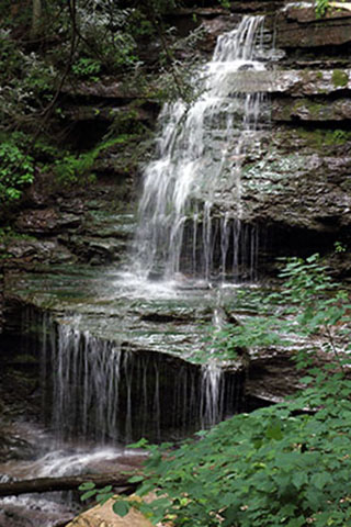
Stunning Waterfalls
Falls Trail at Ricketts Glen State Park
At Ricketts Glen State Park there are 26 miles of trails and 22 named waterfalls. The waterfalls are in the Glens Natural Area -- a National Natural Landmark -- and can be viewed from several hiking trails.
The 7.2-mile Falls Trail is considered “most difficult hiking.” To see most of the waterfalls, you can take a 3.2-mile loop by going on Highland Trail and the Glen Leigh and Ganoga Glen sides of the trail.
The trails follow along beautiful waterfalls ranging in heights from 11 feet to 94 feet. The scenery is well worth the effort; however, the terrain is rocky, can be slippery and descends steeply on both the Ganoga and Glen Leigh sides.
Great Gorge and Meadow Run Trails at Ohiopyle State Park
Located on the southern reaches of the Laurel Ridge, Ohiopyle State Park encompasses approximately 20,500 acres of rugged natural beauty and serves as the gateway to the Laurel Highlands.
There are 79 miles of trails at the park that offer a wide variety of hiking trails from short day hikes to challenging backpacking.
The Great Gorge and Meadow Run trails – among several others -- showcase the beautiful falls throughout the park.
The Great Gorge Trail is a moderately trafficked, more difficult out-and-back trail that features a gorgeous waterfall. This trail begins at the Cucumber Picnic Area and crosses several bridges and roads.
The Meadow Run Trail is an easier 3-mile hike, with trailheads near the ranger station. The pleasant hike to Cucumber Falls and the Cascades will not disappoint!
Turkey Path Trail at Leonard Harrison State Park
Trails at Leonard Harrison State Park lead to beautiful vistas and waterfalls, but traverse very rugged terrain, pass close to many steep cliffs, and may have slippery surfaces.
The Turkey Path Trail is a 2-mile, down-and-back trail, and DCNR rates it at “most difficult hiking.” This difficult trail descends one mile to the bottom of Pine Creek Gorge.
The top half of the trail descends through a series of switchbacks to a view of Little Four-Mile Run at 0.5 miles, then on a short distance to the first waterfall.
The trail continues downward along narrow switchbacks and wooden decking, bridges, and steps. The lowest parts of the trail are along a series of waterfalls, and the trail ends at the Pine Creek Trail.
For more waterfall trails, see DCNR’s interactive map.
Wildlife Watching
Multiple Trails at Bald Eagle State Park
A network of 14.5 miles of hiking trails at Bald Eagle State Park guides hikers through a variety of habitats that offer scenic views and wildlife watching opportunities.
Foster Joseph Sayers Lake at the park is a haven for wildlife, including nesting bald eagles.
Old field habitat provides homes for bluebird, monarch butterfly, woodchuck, and cottontail rabbit, while squirrel and downy woodpecker inhabit the woodlots. A mature oak and hickory forest covers the Bald Eagle Mountain and provides homes for porcupine and turkey.
You can enjoy butterflies while hiking on the 1.5-mile, relatively easy Butterfly Trail. The 2-mile, easy Woapalanne Path provides opportunities to see waterfowl and eagles.
Trails at Worlds End State Park
The extensive forest cover, hemlock valleys, and mountainous terrain of Worlds End State Park in Sullivan County, provide ideal habitat for “big woods” wildlife. The patient observer can find bobcat, coyote, and river otter. More than 200 species of birds have been recorded, including northern goshawk, yellow-bellied flycatcher, and white-throated sparrow.
More than 20 miles of hiking trails can provide you with a fun experience in the wilderness, including Double Run Nature Trail, which is a 1.2-mile, more difficult loop; as well as the longer Link Trail, which is 7 miles of more difficult hiking.
Quehanna Trail in Parker Dam State Park and Moshannon and Elk State Forests
The Quehanna Trail is a 75-mile loop hiking trail in the Pennsylvania Wilds. The trail passes through some of the most wild and beautiful country Pennsylvania has to offer.
Hiking the full loop can take five to six days, and the vistas found throughout the trail are worth seeing.
Nearly 50,000 acres, the Quehanna Wild Area covers parts of Cameron, Clearfield, and Elk counties. This protected wildlife area has been named an Important Bird Area by the Pennsylvania Audubon Society and is home to several species of birds and other animals including elk, deer, and coyotes.
For more wildlife viewing trail opportunities, see DCNR’s interactive map.
Natural Wonders
Boulder Field Trail at Hickory Run State Park
Hickory Run Boulder Field at Hickory Run State Park is a striking boulder-strewn area and is a National Natural Landmark.
The field is 400 by 1,800 feet and at least 12 feet deep. The field’s surface is uneven as it’s made up of loosely packed boulders that are each about four feet in diameter, though some can be as big as 25 feet in diameter.
The state park has 44 miles of hiking trails, three state park natural areas, and miles of trout streams.
The Boulder Field Trail is 3.5 miles long and is considered “more difficult.” Bears, owls, white-tailed deer, turkeys, snowshoe hares and ruffed grouse are sometimes encountered along the trail. Hikers should allow 4 to 5 hours for a roundtrip trek.
Old Loggers Path at Loyalsock State Forest
The Old Loggers Path is a 27.1 mile-long circuit trail located in northeastern Lycoming County. The trail is located entirely on state forest lands that had formerly belonged to the Central Pennsylvania Lumber Co.
The trail layout has taken advantage of the engineering expertise of the early logging railroaders as it follows the grades. The highlights of the trail are the many cuts and fills on the grades, Rock Run (one of the most stunning streams in Pennsylvania), and the vistas that look to the McIntyre Wild Area.
Old Loggers Path is mentioned in “Ghost Lumber Towns of Central Pennsylvania,” a historical logging railroad book.
For more natural areas to explore, visit DCNR’s website.
No matter where you hike or why, it’s important to stay safe. Remember to:
- Check the weather before you hike to avoid storms
- Tell someone where you are going and when you will return; a cell phone can be useful for calling for help, but many sections of the parks do not have cell phone coverage
- Carry drinking water to stay hydrated
- Wear sturdy shoes to protect your feet
- Carry the proper safety equipment, like a first aid kit and a poncho
- Stay on the trail, so you’ don’t get lost or damage fragile habitats
- Observe wildlife from a safe distance
For more information about where to hike, visit DCNR’s hiking webpage and Explore PA Trails.