Waterfalls are beautiful, natural sights that can be the pinnacle of any trip or hike. Pennsylvania’s mountains and flowing streams and rivers have created many scenic waterfalls across the state.
While they can be enjoyable any time of year, most waterfalls are best viewed in the springtime when snow is melting and rainfall tends to be greater, causing water levels to rise and the flow of the falls to be more intense.
No matter the falls adventure you’re looking for -- an intense hike, easy walk-in, a drive-up, something close to home, or a trip across the state -- your waterfall wanderlust can be satisfied right in Pennsylvania’s state parks and forests!
Where are the Falls at State Parks and Forests?
Pennsylvania is home to countless beautiful waterfalls, with many on state park and forest land.
Here are some state park and forest waterfalls across the state to put on your “must-see” list for this year.
Buttermilk Falls and Luke's Falls at Lehigh Gorge State Park
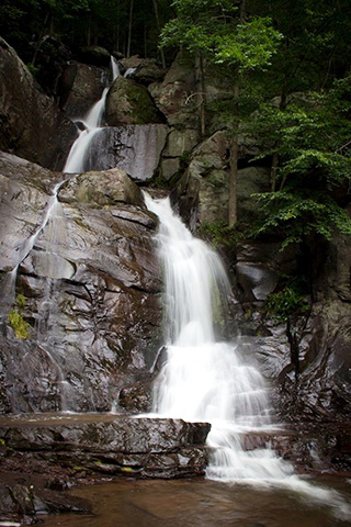
In Lehigh Gorge State Park, the 26 miles of the Lehigh Gorge Trail offers flat, easy hiking or biking along the scenic Lehigh River with several waterfalls along the way.
The state park is known for its deep, steep-walled gorge carved by a river, thick vegetation, rock outcroppings, and waterfalls.
Luke's Falls is located along the Lehigh Gorge Trail, just south of the Rockport Access Area. Buttermilk Falls (pictured above) is located along the Lehigh Gorge Trail, just north of the Rockport Access Area. The falls are not a far walk from the parking lot at the Rockport Access Area; however, there is some downhill walking before reaching the trail.
Cole Run Falls at Forbes State Forest
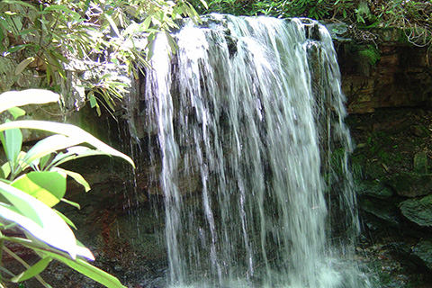
Cole Run Falls is a beautiful 15-foot waterfall on Cole Run, a small perennial stream in Forbes State Forest. The falls are a short 100-foot hike south from the parking lot along Cole Run Road at the trailhead to the two-mile-long Cole Run Trail.
Cole Run winds through wild rhododendron and oak-dominated forests covered with mountain laurel until dropping over a 15-feet high rock ledge and continuing down a rocky drainage to Blue Hoke Creek. The falls are more spectacular in the spring and when there is abundant rain.
Cucumber Falls at Ohiopyle State Park
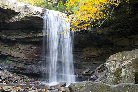
What experts call a bridal veil fall, Cucumber Falls at Ohiopyle State Park drops 30 feet into an amphitheater-like grotto. The creek continues a short way over jumbled boulders before reaching the Youghiogheny River.
You can access Cucumber Falls via the 2.6-mile Great Gorge Trail (marked with green blazes), which begins at the Cucumber Picnic Area and crosses several bridges and roads. The “more difficult” rated trail follows Cucumber Run and passes an area known for its spring wildflowers. The next trail section follows an old tramway used to transport coal to the railroad.
Ohiopyle State Park is home to five breathtaking waterfalls. The others are: Johnathan Run Falls, Cascades Falls, Meadow Run Waterslides, and Ohiopyle Falls. Ohiopyle Falls has its own ADA parking and viewing area by the park office/visitor center.
Falls Trail at Ricketts Glenn State Park
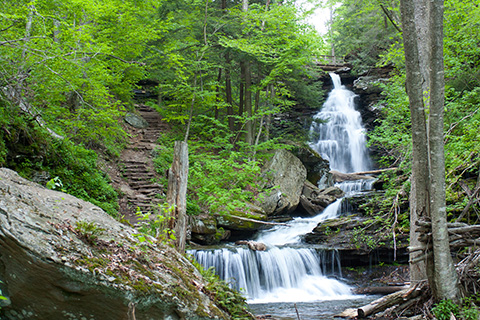
Falls Trail at Ricketts Glen State Park is considered “most difficult” hiking, and provides some of the best waterfall viewing in Pennsylvania. Located within the Glens Natural Area -- a National Natural Landmark -- Falls Trail travels along 22 named, free-flowing waterfalls, ranging in heights from 11 feet to 94 feet, each cascading through rock-strewn clefts in the ancient hillside. The 94-foot Ganoga Falls is the highest of 22 named waterfalls.
The full loop of this trail is 7.2 miles if hiking both the upper and lower sections. To see most of the waterfalls, a 3.2-mile loop can be taken by going on Highland Trail and the Glen Leigh and Ganoga Glen sides of the trail.
The scenery is well worth the effort; however, the terrain is rocky, can be slippery, and descends steeply on both the Ganoga and Glen Leigh sides. Hikers should take extra precautions with trail conditions, wear proper footwear, stay on the trail, and be in good physical condition.
Falls Trail is closed in the winter except for properly equipped ice climbers and hikers. Check with the park if the weather is questionable to ensure you’re permitted to hike when you plan to visit.
Hawk Falls at Hickory Run State Park
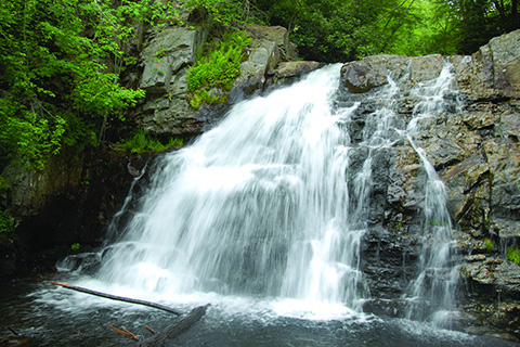
Hawk Falls is a natural 25-foot waterfall located along Hawk Falls Trail, at 0.6-mile out-and-back trail in Hickory Run State Park.
This “more difficult” rated trail begins in rhododendron thickets and hugs the side of a hill down to Hawk Run. A large footbridge crosses the creek. The trail bears right at Mud Run, wanders through a tunnel of rhododendron and ends with a view of Hawk Falls.
Parking is available off of PA 534, just east of the turnpike overpass. Take caution when crossing the busy road to access the trail.
Hells Hollow Falls at McConnells Mill State Park
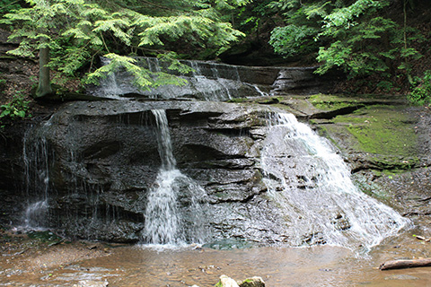
A short hike on Hells Hollow Trail at McConnells Mill State Park ends at Hells Hollow Falls and the remains of a limekiln. Here, you can take in the spectacular Slippery Rock Creek Gorge.
The 0.5-mile, easy hiking trail begins at the Hells Hollow Parking lot and follows and twice crosses Hells Run. Although the main trail is smooth and level, the section by the waterfall can be slippery.
The 930-acre Slippery Rock Gorge was designated a National Natural Landmark and a State Park Natural Area because of the array of wildflowers, habitats, and waterfalls.
There are a total of three waterfalls in McConnells Mill State Park. Kildoo Falls is located off Kennedy Road, and Alpha Falls is located along Kildoo Trail.
Sand Run Falls at Tioga State Forest
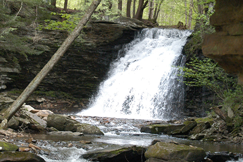
A moderate, three-mile hike (6 miles total) along the Sand Run Trail in Tioga State Forest ends at the gorgeous 30-feet-tall Sand Run Falls, a tributary of Babb Creek.
The Sand Run Falls trail system is located in the Maple Hill Area near Arnot, Pa. The trail begins just off the Arnot Road, west of Arnot, Pa. The Mid State Trail crosses the Sand Run trail near the falls, and a great camping spot is located just below the falls.
This area contains a mixture of hardwood forest, primarily northern hardwoods.
Turkey Path Falls at Leonard Harrison State Park
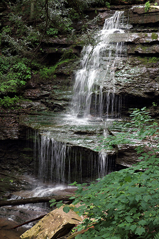
Turkey Path Falls are a reward along the one-mile descent to the bottom of the Pine Creek Gorge on the difficult Turkey Path Trail at Leonard Harrison State Park.
Situated on the east rim of Pennsylvania’s Grand Canyon in the Pennsylvania Wilds, Leonard Harrison State Park has modern facilities, a visitor center, and the most famous scenic views of the canyon.
A beautiful vista, 0.5 mile down the Turkey Path Trail, was constructed by the Youth Conservation Corps in 1978. Shortly after the vista, there is a scenic waterfall along the path on Little Four-Mile Run. Major improvements on the Turkey Path Trail, including steps, observation decks, and hand rails were completed by the Pennsylvania Conservation Corps in 1993.
To access the trail, you can park in the parking lot outside of the visitor center, and walk a few short steps to take in the stunning views, and quickly start your steep descent to the falls.
Preparing to Hike the Falls
With colder temperatures and snowfall still happening in many parts of the state, it’s important to do research before exploring waterfalls, and ask questions like:
- Is the state park open? Are the falls trails open?
- Do I need special equipment to get to the falls?
- What has the weather been like in the area I plan to visit? What is the forecast for when I plan to be there? What should I wear to be the most comfortable and safe?
Many trails that take you to waterfalls can feature steep drop-offs, as well as slippery rocks, mud, and leaves after snow or rainfall. It’s critical to do research about specific trails you plan to trek; some are more advanced than others, and you don’t want to be caught pushing your limits in dangerous conditions.
Helpful Guidelines for Hiking Falls Trails
The following guidelines will help ensure safe and enjoyable hiking experience while exploring state parks and forests with waterfalls and potentially slippery terrain:
- Let someone know where you are hiking and when you should return.
- Wear sturdy boots. Wearing sneakers, sandals, or water shoes may not cut it on difficult falls trails.
- Be prepared. Have proper clothing and equipment (i.e. compass, map, matches, water, food, flashlight, etc.) available in case of an emergency. This is especially important when traveling remote trails or when hiking during non-summer seasons.
- Give yourself plenty of time for your hike. Plan to be off the trails well before dark.
- Stay on the trails. Leaving the trail causes damage to unique natural resources, promotes erosion, and can be dangerous.
- Don’t take shortcuts from one trail section to another. Taking shortcuts down switchbacks is dangerous and causes trail damage.
Learn More about Waterfalls in Pennsylvania
For more information about waterfalls in Pennsylvania state parks and forests, visit DCNR’s waterfalls story map and state parks waterfalls web page.
If you know the state park or forest you’d like to explore, visit the specific park web page or forest web page to learn more about:
- Waterfall location and access
- Falls trail information
- Recreation and land maps and guides
- State park and forest contact information