DCNR’s Bureau of Topographic and Geologic Survey, also known as the Pennsylvania Geological Survey, has a mission of collecting, preserving, and disseminating impartial information on the commonwealth’s geology, geologic resources, and topography for the citizens of Pennsylvania.
The expertise of the bureau’s geologists recently helped site a new well at Moraine State Park that will provide high-quality drinking water and save money.
New Water Supply for Moraine State Park
Moraine State Park opened in Butler County around 1970. At 45 years old, a water treatment plant that tapped surface water from Lake Arthur in the park is nearing the end of its intended life.
DCNR’s Bureau of Facility Design and Construction suggested that perhaps the park could obtain an adequate supply of groundwater from glacial sand and gravel, which might need less treatment than surface water.
That’s when DCNR’s Bureau of Geologic and Topographic Survey was called upon to assist in selecting a site for a water well. Here’s what they did:
- To select a suitable location, survey geologists inventoried records submitted by water-well drillers since 1965, in the area around the western end of the park because that area had been glaciated.
- They used the drillers’ description of the materials that the wells penetrated to draw a topographic map of the surface of the bedrock beneath the glacial sediments.
- A site was selected in the deepest part of a buried valley.
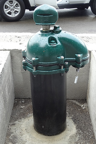
- The well was drilled under supervision by a contractor to 300 feet.
The resulting well, based on a 48-hour pumping test, was measured to be capable of producing more than 2 million gallons of water per day, which considerably exceeds the current need of 50,000 gallons per day by the park.
What do Glaciers have to do with Groundwater?
The topographic map for a portion of Moraine State Park indicated the location of a pre-glacial valley of Muddy Creek. During the Ice Age, an advancing glacier dammed the west-flowing Muddy Creek to form the ancestor of today’s Lake Arthur at Moraine State Park.
When the glacier retreated, it deposited glacial sediment which to this day remains as a buried valley. Why did this matter?
- Some glacial sediments are composed of grains of sand and gravel that are very porous, and can generally hold considerably more water than bedrock.
- Most groundwater flow and storage in rock is through small fractures.
- Valleys generally are eroded where the rock is the weakest. Often that weakness is due to a high concentration of fractures, through which groundwater in bedrock flows.
Based on laboratory tests, the water quality of the new supply well at Moraine State Park is excellent, and will need minimal treatment. This will save considerable money in daily treatment costs.
Sometimes, scientific work produces information that seems to be of mostly academic interest. The presence of a pre-glacial stream valley, now hidden by glacial sediments, is one such example.
But scientific work also has practical applications that can result in significant value for citizens.
Park visitors will soon benefit from the new plentiful source of drinking water!
Available DCNR Resources
You can learn more about geology and groundwater from resources available through DCNR’s Bureau of Topographic and Geologic Survey: